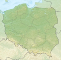
चित्र:Relief Map of Poland.svg

Size of this PNG preview of this SVG file: ६१७ × ६०० पिक्सल. और रिजोल्युशनहरु: २४७ × २४० पिक्सल • ४९४ × ४८० पिक्सल • ७९० × ७६८ पिक्सल • १,०५३ × १,०२४ पिक्सल • २,१०७ × २,०४८ पिक्सल • ८६१ × ८३७ पिक्सल।
खास फाइल (SVG चित्र,सानतिनो ८६१ × ८३७ पिक्सेलहरु, फाइल आकार: ४ मेगाबाइट)
फाइल इतिहास
तिथि/बेलामी क्लिक अरि तैबेला(समय) यो फाइल कसो थ्यो भणी हेद्द सकिन्याछ ।
| तिथि/बेला | थम्बनेल | आयाम | प्रयोगकर्ता | टिप्पणी | |
|---|---|---|---|---|---|
| यैलको | ०५:०५, १ डिसेम्बर २०२१ |  | ८६१ × ८३७ (४ मेगाबाइट) | Puck04 | fixed SVG code (was "W3C-invalid") + cleanup using text editor; contains raster graphics however |
| ०२:३९, ४ फेब्रुअरी २०२१ |  | ८६१ × ८३७ (४.१८ मेगाबाइट) | SANtosito | Vectorized topo | |
| ०३:३७, १ डिसेम्बर २०११ |  | ८६१ × ८३७ (४.८७ मेगाबाइट) | TUBS | == {{int:filedesc}} == {{Information |Description={{en|Relief map of Poland}} Equirectangular projection, N/S stretching 160 %. Geographic limits of the map: * N: 55.2° N * S: 48.7° N * W: 13.8° E * E: 24.5° E |Source={{own}}{{Adobe Il |
फाइल उपयोग
यै चित्रमी निम्न4 पानाहरू जोडिनान्:
विश्वव्यापी फाइल प्रयोग
निम्न और विकिहरुमि यै फाइलको प्रयोग:
- ab.wikipedia.org मि उपयोग
- als.wikipedia.org मि उपयोग
- ar.wikipedia.org मि उपयोग
- av.wikipedia.org मि उपयोग
- azb.wikipedia.org मि उपयोग
- az.wikipedia.org मि उपयोग
- Şablon:Yer xəritəsi Polşa
- Əyri meşə
- Slovinski Milli Parkı
- Dzivna boğazı
- Yamno gölü
- Baltik dili
- Şablon:Dil (coğrafiya)
- Şablon:Dil (coğrafiya)/doc
- Xel dili
- Blendovka səhrası
- Morskie Oko gölü
- Belka-Snejna mağarası
- Karsibur adası
- Ambarlar adası
- Qrabovski adası
- Haliç dağı
- Jives gölü
- Rozeve burnu
- Lısa-Gora dağı
- Avqustovskaya puşa
- Tuxolskie borı
- Rastoçe
- Rominten meşəsi
- Solina gölü
- Qartal Yuvası təbiət parkı
- ban.wikipedia.org मि उपयोग
- Taman Nasional Tatra, Polandia
- Taman Nasional Bieszczady
- Lis taman nasional ring Polandia
- Taman Nasional Wielkopolska
- Taman Nasional Pieniny (Polandia)
- Taman Nasional Gorce
- Taman Nasional Babia Góra
- Taman Nasional Białowieża
- Taman Nasional Biebrza
- Taman Nasional Kampinos
- Taman Nasional Narew
- Taman Nasional Wigry
- Taman Nasional Magura
- Taman Nasional Roztocze
- Taman Nasional Polesie
- Taman Nasional Świętokrzyski
- Taman Nasional Ojców
येइ फाइलओ more global usage हेर:


