
चित्र:Scotland location map.svg

Size of this PNG preview of this SVG file: ४५६ × ६०० पिक्सल. और रिजोल्युशनहरु: १८२ × २४० पिक्सल • ३६५ × ४८० पिक्सल • ५८४ × ७६८ पिक्सल • ७७९ × १,०२४ पिक्सल • १,५५८ × २,०४८ पिक्सल • १,१२८ × १,४८३ पिक्सल।
खास फाइल (SVG चित्र,सानतिनो १,१२८ × १,४८३ पिक्सेलहरु, फाइल आकार: ८१० किलोबाइट)
सारांश:
| बेलिविस्तार |
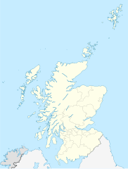
Quadratische Plattkarte, N-S-Streckung 170 %. Geographische Begrenzung der Karte:
Equirectangular projection, N/S stretching 170 %. Geographic limits of the map:
|
||
| मिति | ९ अक्टोबर २००८ (upload date) | ||
| स्रोत |
own work, using
|
||
| लेख्यामान्सु | NordNordWest | ||
| अन्य संस्करणहरू |
Derivative works of this file:
|
||
| SVG genesis |
|


आज्ञापत्र दिन्नाछ़
I, the copyright holder of this work, hereby publish it under the following licenses:

|
GNU Free Documentation Licenseका नीमआ अन्साऱ येइ कागजातलाई साद्द्या, बाण्ण्या रे/या फेलबदेल अद्द्या अनुमति दियीरैछ, Free Software Foundation बठेइ प्रकाशित भया: भर्जन १.२ या कोइलै नौलो भर्जन; बिना कोइ अपरिवर्तनीय धारा, फ्रन्ट कभर पाठ, रे ब्याक कभर पाठ सित। अनुमतियो यक प्रति GNU Free Documentation License शीर्षक भया: खण्डमी समाबेश अरीरैछ। |
यै फाइलको आधिकारिकता निम्न अन्तर्गत निर्धारण गर्याछ । क्रिएटिभ कमन्स एलाइक ३.० अनपोर्टेड लाईसेंस ।
एट्रिब्युसन: Eric Gaba, NordNordWest
- तम खालि भया
- बाण – कार्यको प्रतिलिपि, वितरण र प्रेषितका लाइ
- मिस – कामको अनुशरण अद्दु
- तल दिया सर्तहरु अनुसार:
- एट्रिब्युसन – तमले निश्चित लेखक वा आधिकारिक व्यक्तिले निर्धारण गरया मान्यतामी आधारित होइबर ये कार्यलाई योगदान अद्दु सकंछौ( तर कोइलई सल्लाहकर्ताले आफ्नो इछ्या रे चाहना अनुसार अद्दु सक्दाईनन्)|
- शेयर अलाइक – यदि तम ये कार्यमी के निर्माण, परिवर्तन, रे थप अद्दु चाहन्छौ भन्या येले निर्धारण गर्या निश्चित आधिकारिक प्रारूप भित्र रई बटि मात्र अद्धु सकुन्छौ |
तम आफुना इच्छा अन्साऽरो अनुमतिपत्र छान्न सकन्छौ|
फाइल इतिहास
तिथि/बेलामी क्लिक अरि तैबेला(समय) यो फाइल कसो थ्यो भणी हेद्द सकिन्याछ ।
| तिथि/बेला | थम्बनेल | आयाम | प्रयोगकर्ता | टिप्पणी | |
|---|---|---|---|---|---|
| यैलको | ००:१२, १० अक्टोबर २००८ | | १,१२८ × १,४८३ (८१० किलोबाइट) | NordNordWest | {{Information |Description= {{de|Positionskarte von Schottland, Vereinigtes Königreich}} Quadratische Plattkarte, N-S-Streckung 170 %. Geographische Begrenzung der Karte: * N: 61.0° N * S: 54.5° N * W: |
फाइल उपयोग
यै चित्रमी निम्नपाना जोडिनान:
विश्वव्यापी फाइल प्रयोग
निम्न और विकिहरुमि यै फाइलको प्रयोग:
- ab.wikipedia.org मि उपयोग
- af.wikipedia.org मि उपयोग
- Gebruiker:Laurens
- Rugbywêreldbeker 2007
- Skerryvore
- Sjabloon:Liggingkaart Skotland
- Aberdeen (dubbelsinnig)
- Auchtermuchty
- Inverness
- Kirkwall
- Gruinard-eiland
- Lockerbie
- Ben Nevis
- Skara Brae
- Govan
- Verenigde Rugbykampioenskap
- Aberfoyle, Stirling
- Alloway
- Skotse nasionale krieketspan
- Dumfries
- Glen Coe
- Bonnybridge
- Ayr
- Luss
- ar.wikipedia.org मि उपयोग
- arz.wikipedia.org मि उपयोग
- ast.wikipedia.org मि उपयोग
- azb.wikipedia.org मि उपयोग
येइ फाइलओ more global usage हेर: