
चित्र:LA County Incorporated Areas Los Angeles highlighted.svg

Size of this PNG preview of this SVG file: ७३० × ५९९ पिक्सल. और रिजोल्युशनहरु: २९२ × २४० पिक्सल • ५८५ × ४८० पिक्सल • ९३५ × ७६८ पिक्सल • १,२४७ × १,०२४ पिक्सल • २,४९४ × २,०४८ पिक्सल • ९५० × ७८० पिक्सल।
खास फाइल (SVG चित्र,सानतिनो ९५० × ७८० पिक्सेलहरु, फाइल आकार: २६१ किलोबाइट)
सारांश:
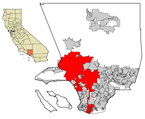
| बेलिविस्तार | This map shows the incorporated areas in Los Angeles County, California. Los Angeles is highlighted in red. I created it in Inkscape using data from the Los Angeles County Website (Los Angeles County Incorporated Area and District Map (PDF). |
| मिति | |
| स्रोत | My own work, based on public domain information. Though I strove to be as accurate in the detail as possible, the information shown is not guaranteed to be completely accurate. |
| लेख्यामान्सु | Ixnayonthetimmay |
| छुटकारा (यो चित्र पुनप्रयोग गद्द) |
Public Domain |
| अन्य संस्करणहरू | See Category:Maps of Los Angeles County, California for other versions of this image. |
आज्ञापत्र दिन्नाछ़
| I, the copyright holder of this work, release this work into the public domain. This applies worldwide. In some countries this may not be legally possible; if so: I grant anyone the right to use this work for any purpose, without any conditions, unless such conditions are required by law. |
फाइल इतिहास
तिथि/बेलामी क्लिक अरि तैबेला(समय) यो फाइल कसो थ्यो भणी हेद्द सकिन्याछ ।
| तिथि/बेला | थम्बनेल | आयाम | प्रयोगकर्ता | टिप्पणी | |
|---|---|---|---|---|---|
| यैलको | १३:०४, २६ जुन २००७ | | ९५० × ७८० (२६१ किलोबाइट) | Ixnayonthetimmay | == Summary == {{Information |Description=This map shows the incorporated areas in Los Angeles County, California. Los Angeles is highlighted in |
फाइल उपयोग
यै चित्रमी निम्नपाना जोडिनान:
विश्वव्यापी फाइल प्रयोग
निम्न और विकिहरुमि यै फाइलको प्रयोग:
- af.wikipedia.org मि उपयोग
- als.wikipedia.org मि उपयोग
- ang.wikipedia.org मि उपयोग
- ar.wikipedia.org मि उपयोग
- arz.wikipedia.org मि उपयोग
- ast.wikipedia.org मि उपयोग
- azb.wikipedia.org मि उपयोग
- bg.wikipedia.org मि उपयोग
- bh.wikipedia.org मि उपयोग
- bn.wikipedia.org मि उपयोग
- ca.wikipedia.org मि उपयोग
- chy.wikipedia.org मि उपयोग
- de.wikipedia.org मि उपयोग
- diq.wikipedia.org मि उपयोग
- el.wikipedia.org मि उपयोग
- en.wikipedia.org मि उपयोग
- Los Angeles
- Los Angeles Police Department
- Harbor Gateway, Los Angeles
- Municipal annexation in the United States
- Category:Neighborhoods in Los Angeles
- National Register of Historic Places listings in Los Angeles
- Killing of Ezell Ford
- Wikipedia talk:WikiProject China/Archive 26
- Talk:New York (state)/Archive 7
- User:Hparham865
- User:Nate.beisheim/sandbox10
- en.wikinews.org मि उपयोग
- es.wikipedia.org मि उपयोग
- eu.wikipedia.org मि उपयोग
- ext.wikipedia.org मि उपयोग
- fa.wikipedia.org मि उपयोग
- fi.wikipedia.org मि उपयोग
- fo.wikipedia.org मि उपयोग
- fr.wikipedia.org मि उपयोग
- Los Angeles
- Projet:Charte graphique/Domaine géographique
- Los Angeles Police Department
- Modèle:Infobox Ville des États-Unis
- Modèle:Infobox Ville des États-Unis/Documentation
- Gangster Squad (LAPD)
- Community Resources Against Street Hoodlums
- Division métropolitaine du Los Angeles Police Department
- Modèle:Infobox Ville des États-Unis/Bac à sable
- fr.wikinews.org मि उपयोग
- fy.wikipedia.org मि उपयोग
- ga.wikipedia.org मि उपयोग
येइ फाइलओ more global usage हेर: